Loading...
Way: 198835441
Version #1
Added roads in Quezon City
Tags
| highway | tertiary |
|---|---|
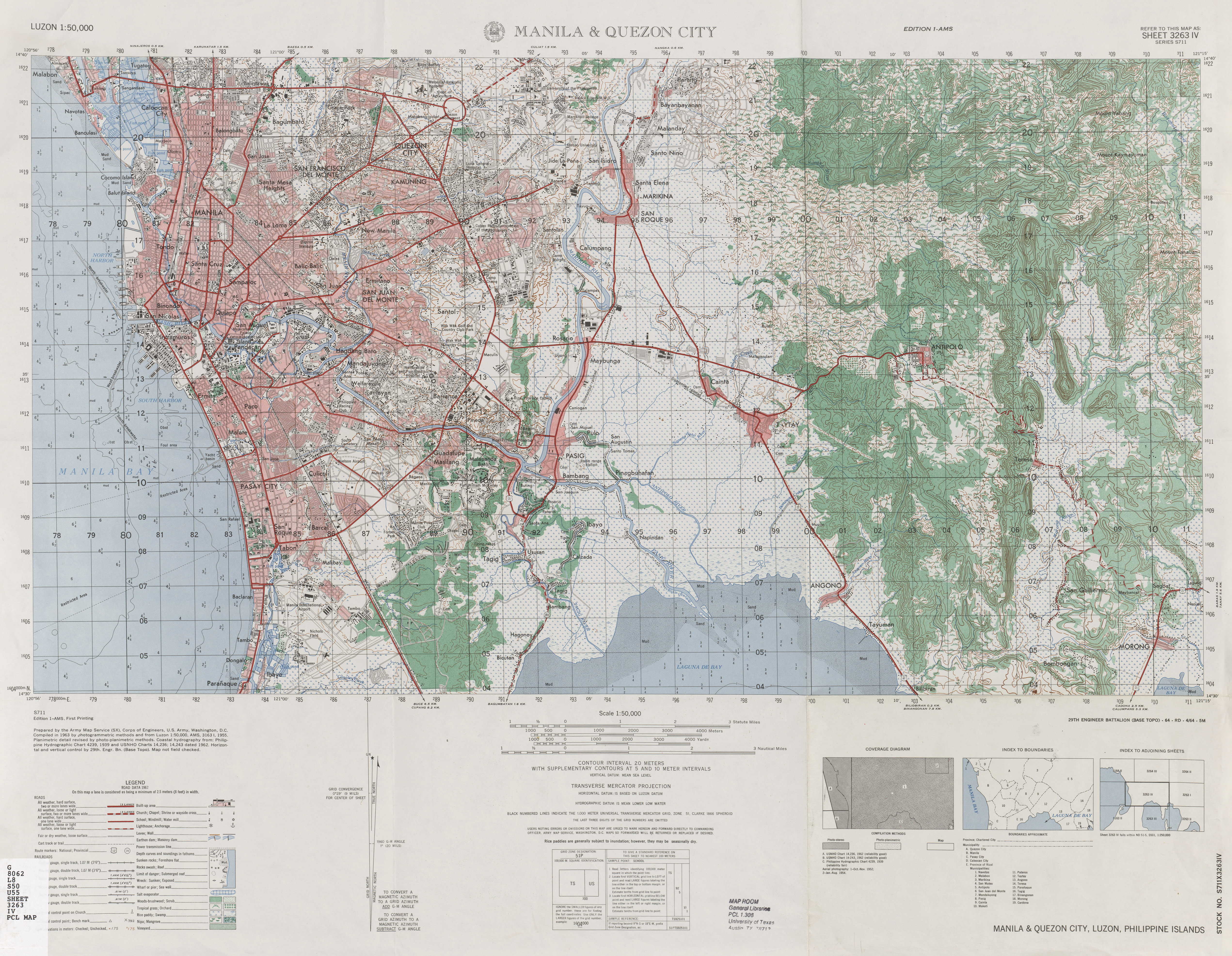
| source | https://maps.lib.utexas.edu/maps/ams/luzon_50k/txu-pclmaps-oclc-10282124-manila-and-quezon-city.jpg |
| start_date | 1963 |
Nodes
8 nodes
- 2096541728 (part of way 198562337)
- 2096541808 (part of way 198835449)
- 2096541729 (part of way 198835450)
- 2096541727 (part of way 198835440)
- 2096541732 (part of way 198835442)
- 2096541730 (part of way 198835445)
- 2096541765 (part of way 198835446)
- 2096541731 (part of ways 198835451 and 198835526)
Welcome to OpenHistoricalMap!
OpenHistoricalMap is an interactive map of the world throughout history, created by people like you and dedicated to the public domain.
OpenHistoricalMap is a charter project of OpenStreetMap U.S., a 501(c)(3) nonprofit organization affiliated with the OpenStreetMap Foundation. Technical development is supported by GreenInfo Network and Development Seed.
Map Layers
Enable overlays for troubleshooting the map
Map Key
Share
Link or HTML
Geo URI
Image
Only the Standard, Cycle Map and Transport layers can be exported as an image
300 km
100 mi
Range
-
March 26, 1925
mm/dd/yyyy
1/1/1825
1/1/1825
mm/dd/yyyy
12/31/2025
12/31/2025
Time Jump
Speed
| https://openstreetmap.org/copyright | https://openstreetmap.org |
| Copyright OpenHistoricalMap and contributors, under an open license | |