Loading...
Way History: 198794942
Version #1
Added and modified places
Tags
| building | yes |
|---|---|
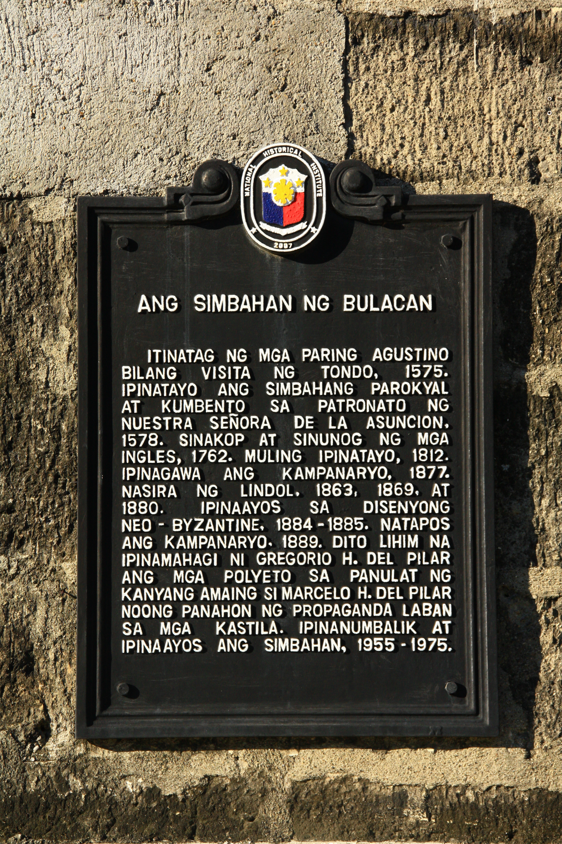
| source | https://upload.wikimedia.org/wikipedia/commons/8/85/Bulacan_Church_historical_marker.jpg |
| start_date | 1812 |
| wikidata | Q25247504 |
| wikipedia | en:Our Lady of Assumption Church (Bulakan) |
Nodes
Welcome to OpenHistoricalMap!
OpenHistoricalMap is an interactive map of the world throughout history, created by people like you and dedicated to the public domain.
OpenHistoricalMap is a charter project of OpenStreetMap U.S., a 501(c)(3) nonprofit organization affiliated with the OpenStreetMap Foundation. Technical development is supported by GreenInfo Network and Development Seed.
| https://openstreetmap.org/copyright | https://openstreetmap.org |
| Copyright OpenHistoricalMap and contributors, under an open license | |