Loading...
Way: 198771631
Version #2
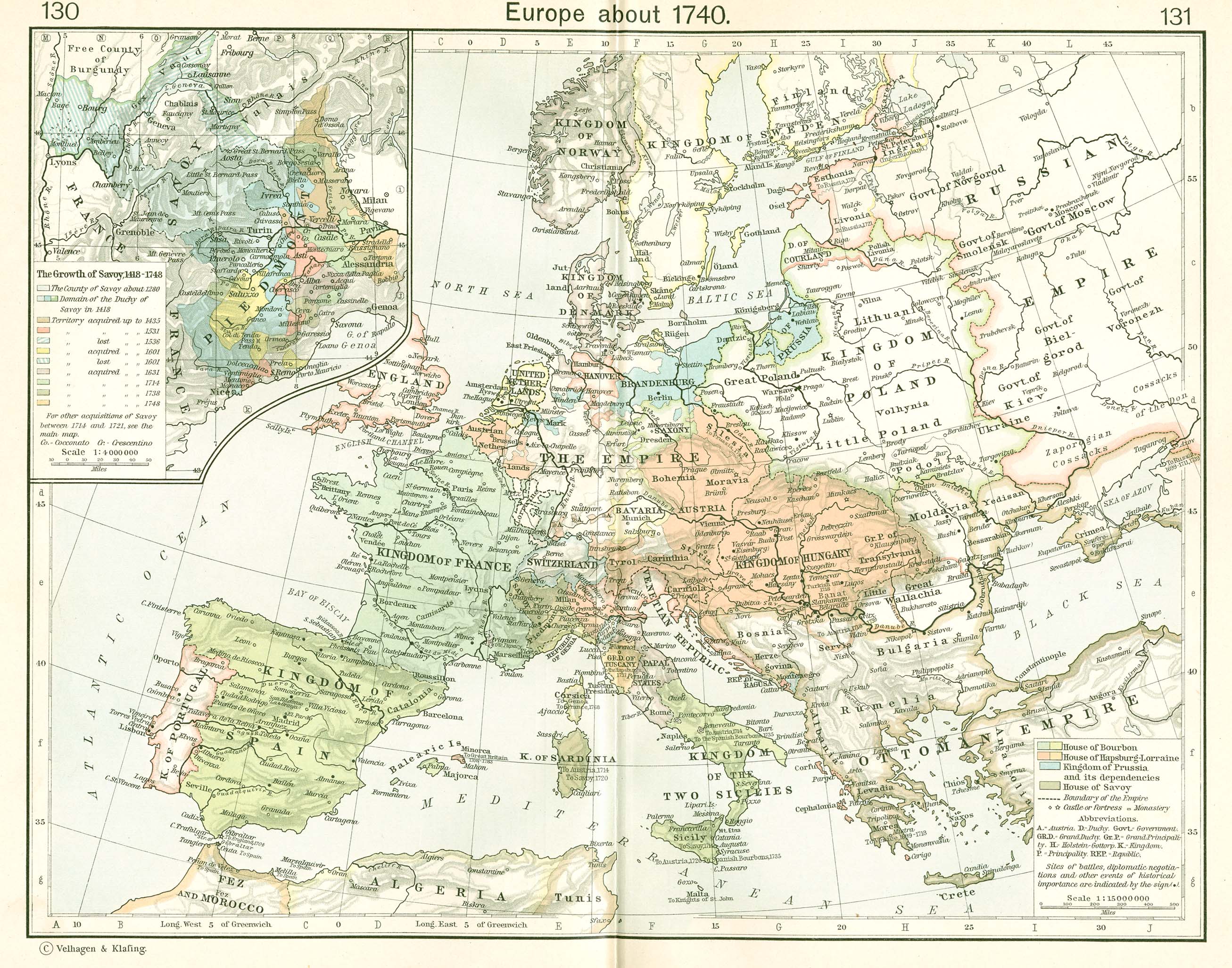
updating borders for Russian territory additions from Sweden as part of treat of Nystad
Tags
| end_date | 1724 |
|---|---|
| fixme | precision - rough sketch |
| source | Shepherd Atlas of World History |
| source:map | https://maps.lib.utexas.edu/maps/historical/shepherd_1911/shepherd-c-130-131.jpg |
| source:note | hand-drawn from visual alignment |
| start_date | 1721-09-10 |
| start_date:cause | Treaty of Nystadt demarcing the Russian-Swedish border signed 10 Sep 1721 after Great Northern War |
Part of
1 relation
- Relation Russian Empire (1721-1724) (2696913) (as outer)
Nodes
20 nodes
Welcome to OpenHistoricalMap!
OpenHistoricalMap is an interactive map of the world throughout history, created by people like you and dedicated to the public domain.
OpenHistoricalMap is a charter project of OpenStreetMap U.S., a 501(c)(3) nonprofit organization affiliated with the OpenStreetMap Foundation. Technical development is supported by GreenInfo Network and Development Seed.
| https://openstreetmap.org/copyright | https://openstreetmap.org |
| Copyright OpenHistoricalMap and contributors, under an open license | |