Way History: [1962 – ] (198765375)
Version #1
Added and modified places
Tags
| highway | residential |
|---|---|
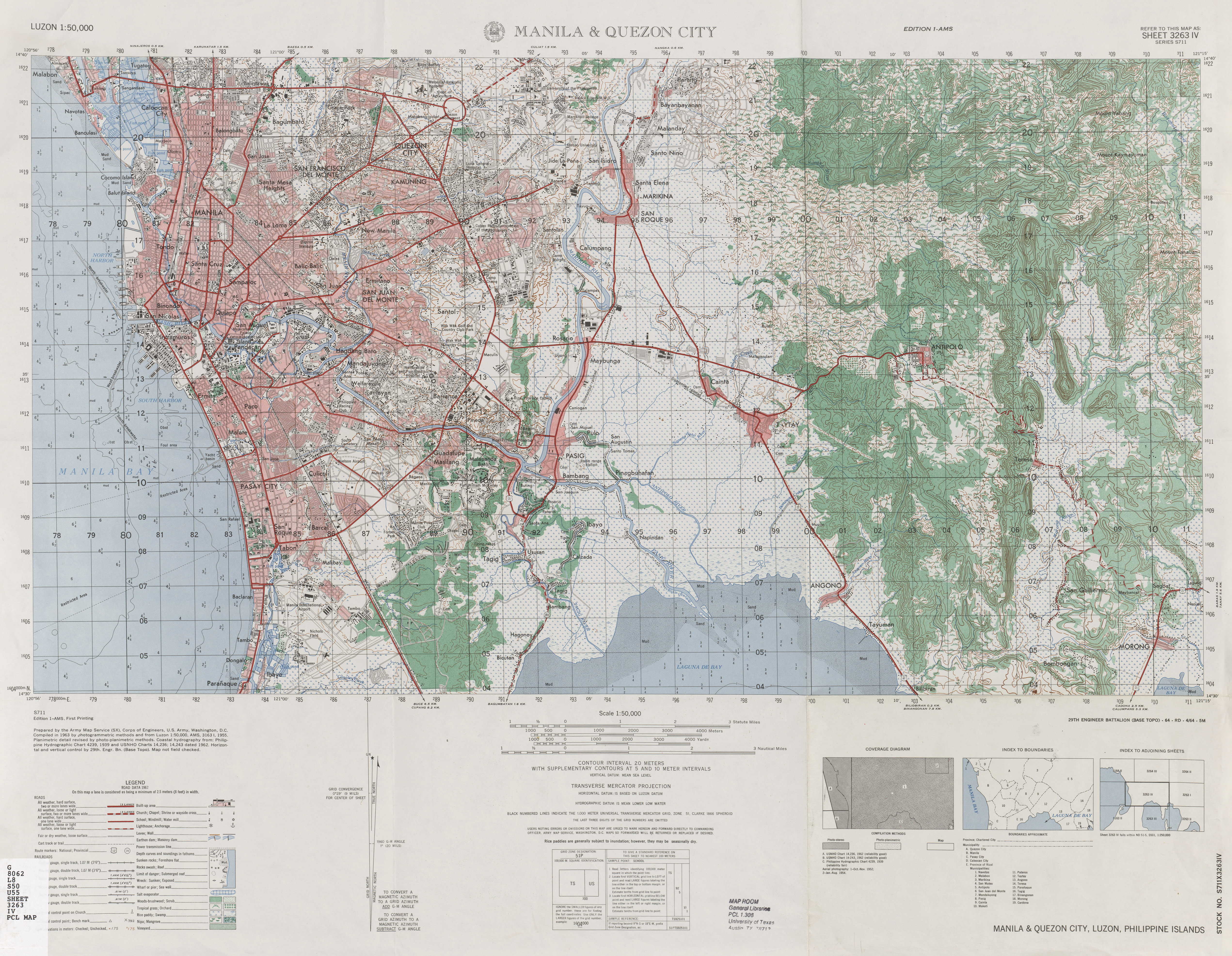
| source | https://maps.lib.utexas.edu/maps/ams/luzon_50k/txu-pclmaps-oclc-10282124-manila-and-quezon-city.jpg |
| start_date | 1962 |
Nodes
7 nodes
Welcome to OpenHistoricalMap!
OpenHistoricalMap is an interactive map of the world throughout history, created by people like you and dedicated to the public domain.
OpenHistoricalMap is a charter project of OpenStreetMap U.S., a 501(c)(3) nonprofit organization affiliated with the OpenStreetMap Foundation. Technical development is supported by GreenInfo Network and Development Seed.
| https://www.openhistoricalmap.org/copyright | https://www.openhistoricalmap.org |
| OpenHistoricalMap is dedicated to the public domain except where otherwise noted. | |