Loading...
Way: Antonio Rivera [1898 – ] (198760343)
Version #2
Added and modified places
Tags
| highway | tertiary |
|---|---|
| name | Antonio Rivera |
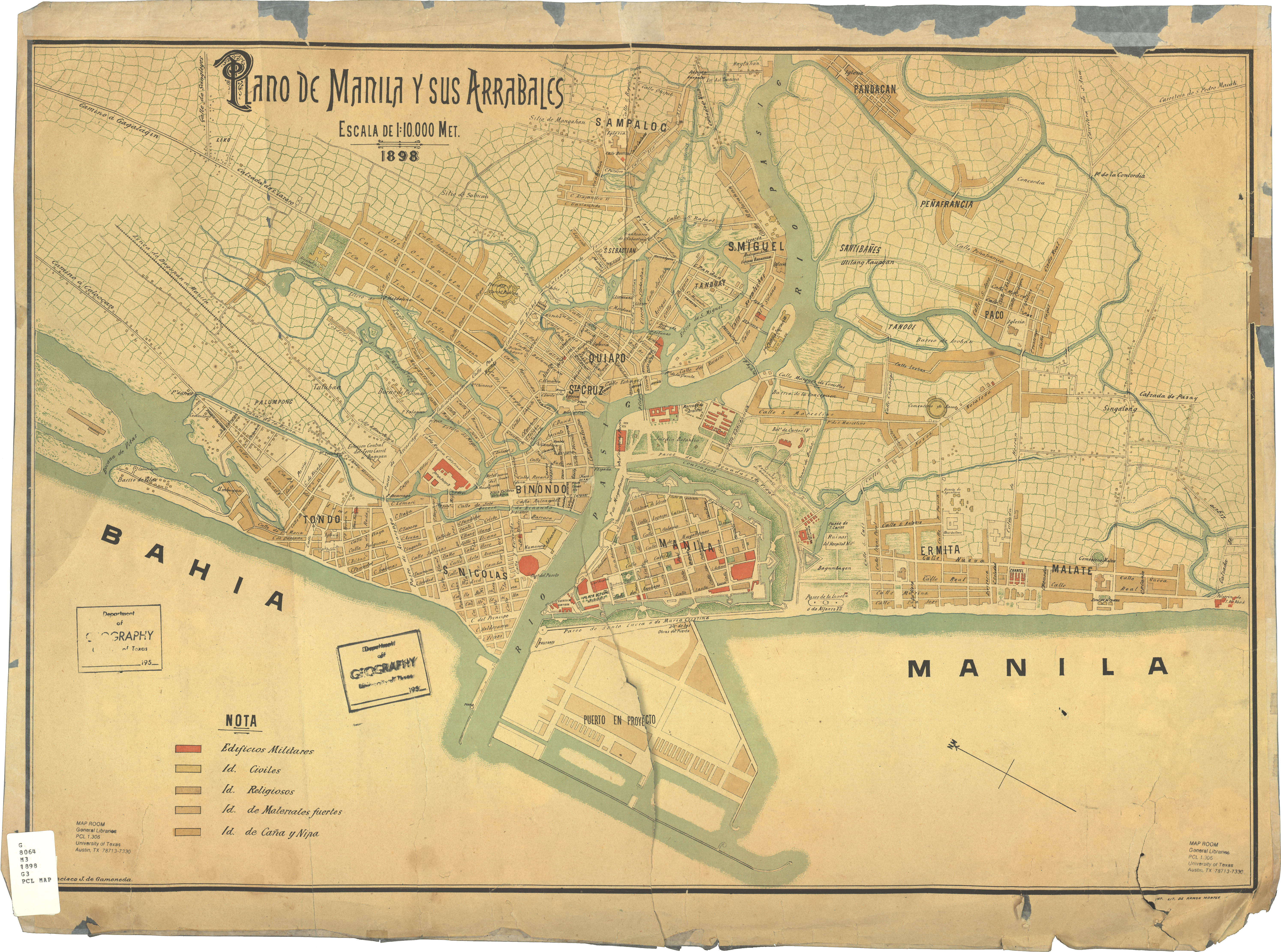
| source | https://legacy.lib.utexas.edu/maps/historical/manila_and_suburbs_1898.jpg |
| start_date | 1898 |
Nodes
7 nodes
- 2090521418 (part of ways [1940 – ] (198565859) and Antonio Rivera [1915 – ] (198557098))
- 2090521417 (part of way [1935 – ] (198760493))
- 2095162105 (part of way [1940 – ] (198760497))
- 2090521416 (part of way [1934 – ] (198565858))
- 2090521420 (part of ways [1875 – ] (198552499) and [1905] (198832115))
- 2090521419
- 2090475054 (part of way [1875 – ] (198552491))
Welcome to OpenHistoricalMap!
OpenHistoricalMap is an interactive map of the world throughout history, created by people like you and dedicated to the public domain.
OpenHistoricalMap is a charter project of OpenStreetMap U.S., a 501(c)(3) nonprofit organization affiliated with the OpenStreetMap Foundation. Technical development is supported by GreenInfo Network and Development Seed.
| https://www.openhistoricalmap.org/copyright | https://www.openhistoricalmap.org |
| OpenHistoricalMap is dedicated to the public domain except where otherwise noted. | |