Loading...
Way: 198657651
Version #1
Added and modified places
Tags
| highway | tertiary |
|---|---|
| note | Start date arbitrary |
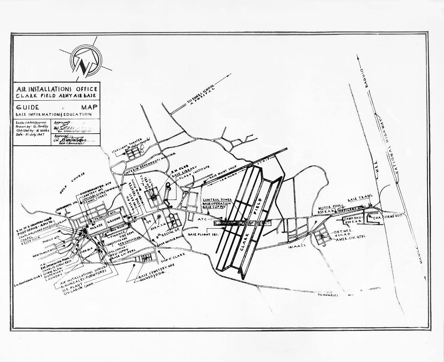
| source | aerial imagery;https://www.clarkab.org/maps/cabmap47.jpg |
| start_date | 1938 |
Nodes
23 nodes
- 2093543326
- 2093543327
- 2093543328
- 2093543329
- 2093543330
- 2093543331
- 2093543332
- 2093543333
- 2093543334
- 2093543335
- 2093543336
- 2093543337
- 2093543338 (part of ways 198657718 and 198657719)
- 2093543339
- 2093543340
- 2093543341
- 2093543373 (part of way 198657656)
- 2093543342
- 2093543343
- 2093543344
- 2093543346 (part of way 198657652)
- 2093543433 (part of way 198657665)
- 2090587073 (part of ways 198657663 and 198563480)
Welcome to OpenHistoricalMap!
OpenHistoricalMap is an interactive map of the world throughout history, created by people like you and dedicated to the public domain.
GreenInfo Network is a nonprofit social-good mapping and communications organization that helps nonprofits and government agencies achieve social, environmental, and other goals using a range of tools, including human-centered design practices, collaborative development, and open source web and geospatial tools.
Development Seed is an engineering and product company that is accelerating the application of earth data to our biggest global challenges. Development Seed leverages massive earth data, cloud computing, geospatial AI, and thoughtful product development.
| https://openstreetmap.org/copyright | https://openstreetmap.org |
| Copyright OpenHistoricalMap and contributors, under an open license | |