Loading...
Way History: 198557090
Version #2
Added and modified places in Manila
Tags
| highway | secondary |
|---|---|
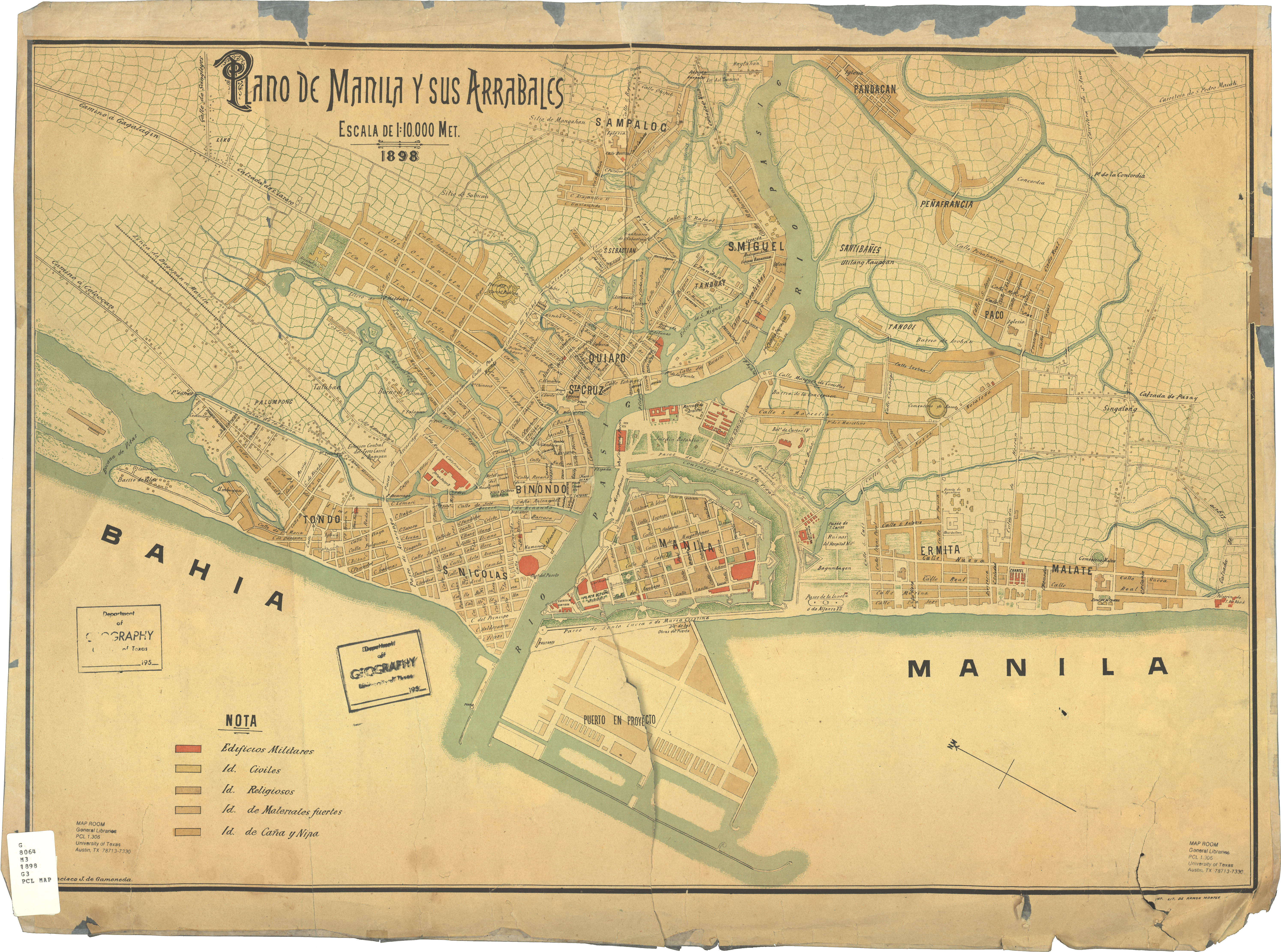
| source | https://legacy.lib.utexas.edu/maps/historical/manila_and_suburbs_1898.jpg |
| start_date | 1898 |
Nodes
5 nodes
- 2090488502 (part of ways Oroquieta (198557088) and 198553599)
- 2090523150 (part of way M. Hizon (198557475))
- 2090521400 (part of ways Felix Huertas (198557473), 198557089, and 198832443)
- 2090523181 (part of way Sulu (198557479))
- 2090521401 (part of ways 198832148, 198557488, and 198557489)
Version #1
Added and modified places in Manila
Tags
| highway | tertiary |
|---|---|
| source | https://legacy.lib.utexas.edu/maps/historical/manila_and_suburbs_1898.jpg |
| start_date | 1898 |
Nodes
3 nodes
- 2090488502 (part of ways Oroquieta (198557088) and 198553599)
- 2090521400 (part of ways Felix Huertas (198557473), 198557089, and 198832443)
- 2090521401 (part of ways 198832148, 198557488, and 198557489)
Welcome to OpenHistoricalMap!
OpenHistoricalMap is an interactive map of the world throughout history, created by people like you and dedicated to the public domain.
OpenHistoricalMap is a charter project of OpenStreetMap U.S., a 501(c)(3) nonprofit organization affiliated with the OpenStreetMap Foundation. Technical development is supported by GreenInfo Network and Development Seed.
| https://openstreetmap.org/copyright | https://openstreetmap.org |
| Copyright OpenHistoricalMap and contributors, under an open license | |