Way: 4th (Concord) Street (198530162)
Version #6
Added more street grids of 1797; fixed Collect Pond outlet
Tags
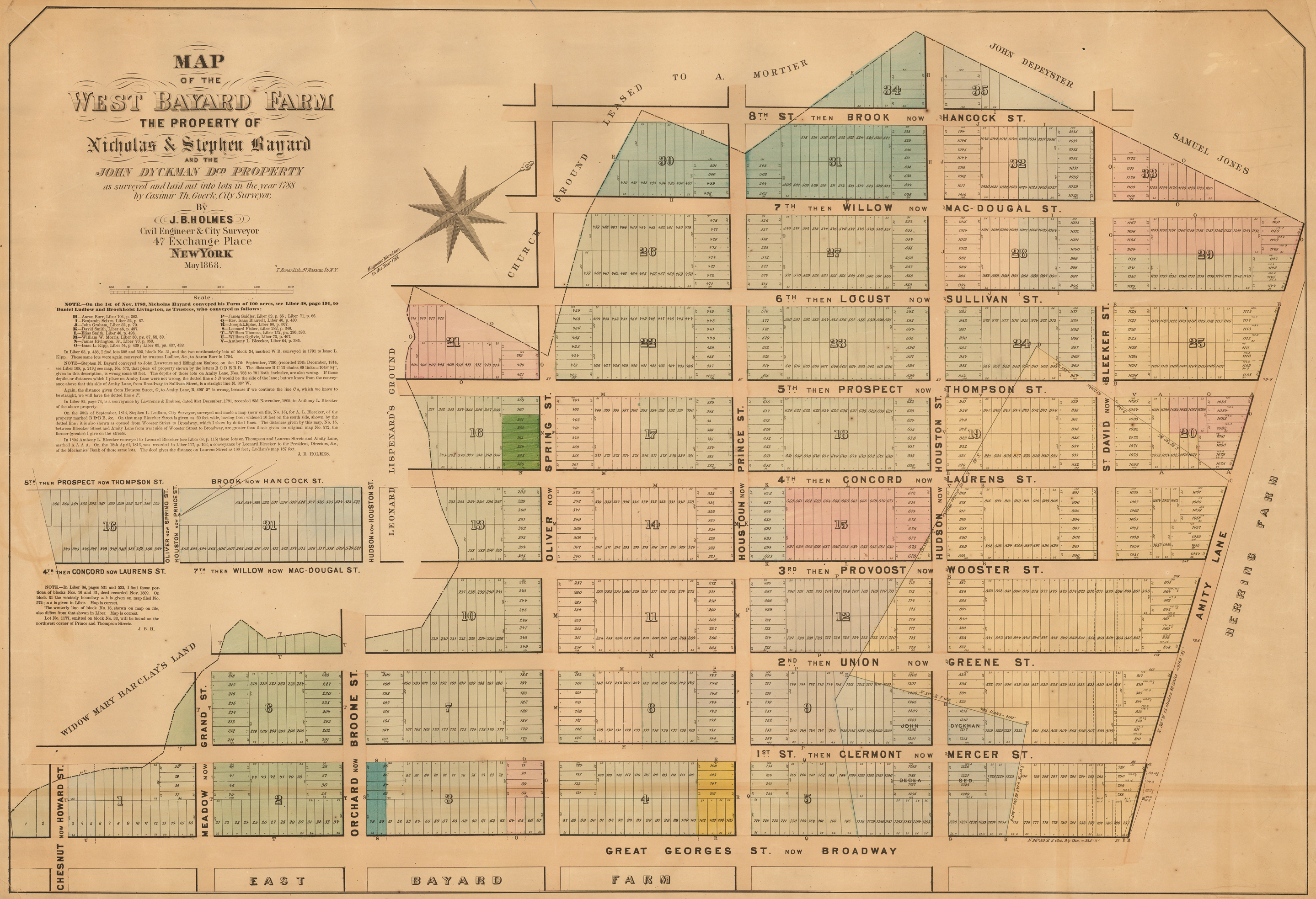
| end_date | 1800 |
|---|---|
| highway | unclassified |
| name | 4th (Concord) Street |
| source | https://upload.wikimedia.org/wikipedia/commons/5/5d/West_Bayard_Farm.jpg |
| source:name | Street Grid of the West Bayard Farm |
| start_date | 1788 |
Nodes
10 nodes
- 2090160939 (part of ways Laurens Street (198530240) and Laurens Street (198640132))
- 2093042054 (part of ways Laurens Street (198640132) and Bleecker Street (198766119))
- 2091792027 (part of ways Laurens Street (198640132) and Houston Street (198761964))
- 2091792052 (part of ways Laurens Street (198640132) and West Houston Street (198651039))
- 2091792060 (part of ways Laurens Street (198640132) and West Houston Street (198592509))
- 2091800287 (part of ways Laurens Street (198640132) and Prince Street (198592955))
- 2093040523 (part of ways Laurens Street (198640132) and Spring Street (198592960))
- 2093040526 (part of ways Orchard Street (198640366), Broome Street (198640368), and Laurens Street (198640132))
- 2090160937 (part of ways Grand Street (198639917), Grand Street (198640369), Meadow Street (198640370), and Laurens Street (198640132))
- 2090160938 (part of ways Laurens Street (198640132), Canal Street (198530153), West Broadway (198640137), and Chapel Street (198639911))
Welcome to OpenHistoricalMap!
OpenHistoricalMap is an interactive map of the world throughout history, created by people like you and dedicated to the public domain.
GreenInfo Network is a nonprofit social-good mapping and communications organization that helps nonprofits and government agencies achieve social, environmental, and other goals using a range of tools, including human-centered design practices, collaborative development, and open source web and geospatial tools.
Development Seed is an engineering and product company that is accelerating the application of earth data to our biggest global challenges. Development Seed leverages massive earth data, cloud computing, geospatial AI, and thoughtful product development.
| https://openstreetmap.org/copyright | https://openstreetmap.org |
| Copyright OpenHistoricalMap and contributors, under an open license | |