Loading...
Node: Rheinfall (1230090972)
Unable to contact the OHM server for additional inspector details. Please try again later.
Version #2
(no comment)
- Edited by osmosis_user_0
- Changeset #1
- Location: 47.6778348, 8.6153284
Tags
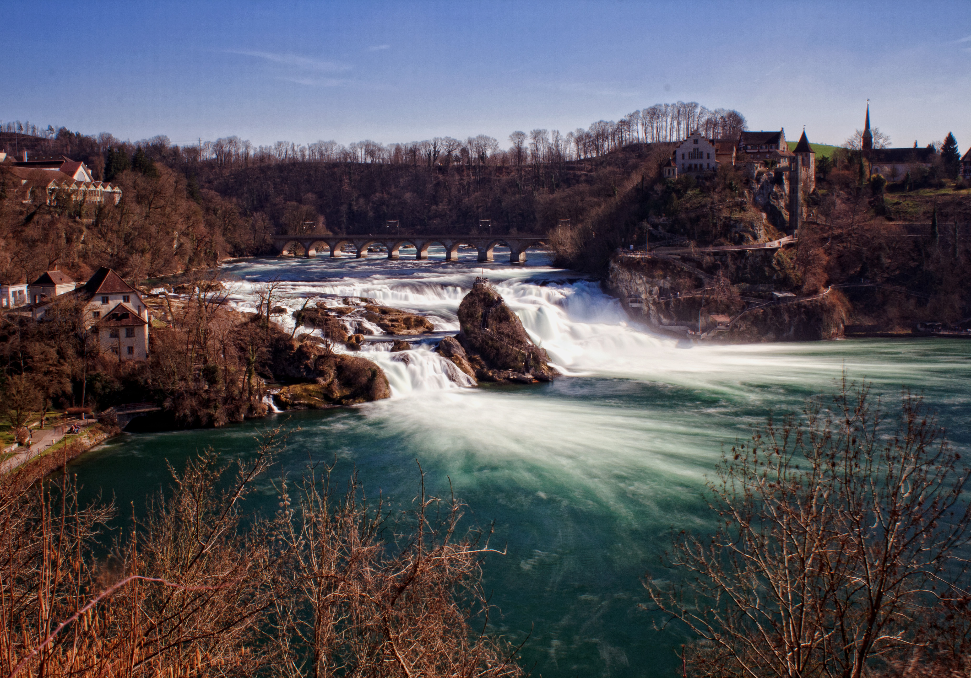
| image | http://upload.wikimedia.org/wikipedia/commons/a/a8/Rheinfall_totale.jpg |
|---|---|
| image:panorama | http://upload.wikimedia.org/wikipedia/commons/9/90/Rheinfall_Panorama_revised.jpg |
| importance | national |
| name | Rheinfall |
| name:bg | Райнфал |
| name:cy | Rhaeadr y Rhein |
| name:de | Rheinfall |
| name:en | Rhine Falls |
| name:eo | Rhaeadr y Rhein |
| name:es | Cataratas del Rin |
| name:fr | Chutes du Rhin |
| name:he | מפלי הריין |
| name:it | Cascate del Reno |
| name:ja | ライン滝 |
| name:la | Reino krioklys |
| name:no | Rhinfallet |
| name:os | Рейны æхсæрдзæн |
| name:ro | Cascada Rinului |
| name:ru | Рейнский водопад |
| name:sv | Rhenfallet |
| name:ta | ரைன் அருவி |
| name:zh | 萊茵瀑布 |
| note | Europas grösster Wasserfall / Europe biggest water falls |
| tourism | attraction |
| waterway | waterfall |
| wikipedia | de:Rheinfall |
Part of
1 way
Welcome to OpenHistoricalMap!
OpenHistoricalMap is an interactive map of the world throughout history, created by people like you and dedicated to the public domain.
OpenHistoricalMap is a charter project of OpenStreetMap U.S., a 501(c)(3) nonprofit organization affiliated with the OpenStreetMap Foundation. Technical development is supported by GreenInfo Network and Development Seed.
Map Layers
Enable overlays for troubleshooting the map
Map Key
Share
Link or HTML
Geo URI
Image
Only the Standard, Cycle Map and Transport layers can be exported as an image
300 km
100 mi
Range
-
March 17, 1925
mm/dd/yyyy
1/1/1825
1/1/1825
mm/dd/yyyy
12/31/2025
12/31/2025
Time Jump
Speed
| https://openstreetmap.org/copyright | https://openstreetmap.org |
| Copyright OpenHistoricalMap and contributors, under an open license | |